The continuation! As soon as we arrived in the village we decided to have a short walk up on a hill nearby. This time we chose slightly different route, so we were able to climb to the peak and observe landscapes from both sides of the mountain. Lucky enough, we finished long before it started raining. Actually, it was literally pouring that night. Here is a small beehive farm established right nearby the ATV track. Very typical for New Zealand – as you can lease your land for cattle, sheep or even bees! The size of the land doesn’t matter.

A view to the old mountain road we walked, local hills and wind farm at the horizon:

Giant wood ferns. Can reach up to 20 meters in height:
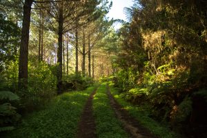
I think the road up to the hill was made mainly for logging trees and is used primarily by the owner of the mountain. Typical Siberian landscapes, isn’t it?
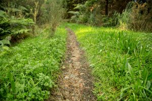
A small track from ATV was very welcome as all the grass nearby was very wet and slippery:
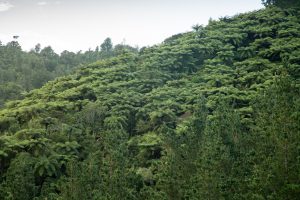
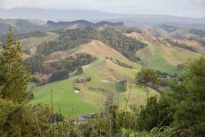
A view of south-eastern part of the valley through the green wall of ferns and trees. Scroll to the right to get it focused (yes, it’s a slideshow):


Frankly saying, I’m not good enough in orienteering. I mean, we didn’t get lost. Just imagine: you’re standing at the foot of the mountain, you see one ridge going up, then it turns right where it merges with another ridge, then it goes up again for another 50-70 meters and merges with third ridge and so on. Then you make a route in your mind: go up, turn right, then up, turn right again, then up, turn left… Sounds like a piece of cake but… it turns out to be A BIT difficult when you walk in the forest, without having a map and not being able to see any other landmarks because of the high trees and ferns:

Anyway, this time we made it all the way to the top of the mountain. Surprisingly, it was very dry at the summit. The sun was setting, so I literally had a few minutes to shoot a few pictures before it got dark:

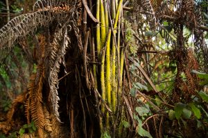
A bit unusual fern with a very bright yellowish stem. Must be a fungi of some kind, I guess?
One thing to note: I always struggle to judge the right altitude. Standing at the summit and observing the valley down the hill, my friends house and a few others I had no idea which altitude we were at. I think I might need to walk there again, and record this walk with my new smart watches. Optionally, I can search for that place using terrain map? What do you think? Is this 200 meters above the sea level? 400 or may be 300 meters? ))
On the way back we watch a sunset from west side of the hill, where you can also see part of Raglan harbour

Also, as it was pretty dark, I managed to get close enough to the bees without being stung:

Shall I buy a drone?!)
Ivan Grigoryev's Blog
Living in New Zealand. Blogging about the country, beautiful places, everyday life.
Do a skydive - halfway completed; get 1400 - still working on; reach 300kph - completed by 96.6%